Category:Lewis Bandt Bridge
Jump to navigation
Jump to search
| Object location | | View all coordinates using: OpenStreetMap |
|---|
bridge in Australia  | |||||
| Upload media | |||||
| Instance of | |||||
|---|---|---|---|---|---|
| Made from material | |||||
| Location | Victoria, AUS | ||||
| Inception |
| ||||
| Date of official opening |
| ||||
 | |||||
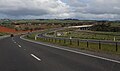
English: The Lewis Bandt Bridge is an Australian feature bridge over the Moorabool River, close to the southern end of Stage 2 of the Geelong Ring Road.
Media in category "Lewis Bandt Bridge"
The following 3 files are in this category, out of 3 total.
-
 Geelong Bypass, Fyansford v2, 2007.jpg 1,024 × 683; 105 KB
-
 Geelong Bypass, Fyansford, 2007.jpg 1,024 × 683; 144 KB
-
 Geelong Ring Road section 2 2009.jpg 1,024 × 602; 104 KB

